Trail Segment Maps
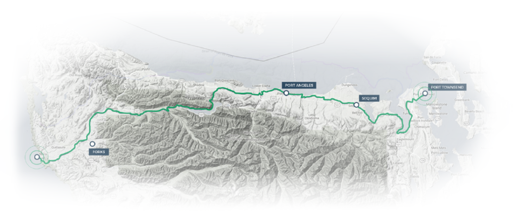
In the side menu to the right you’ll see four trail segment links. These go to their own pages with embedded Ride with GPS maps. Below is some detail on how to read these maps, as well as general route info.
Trail Surfaces – Completed off-road paved trail is shown with a Green line. Most paving is asphalt, 10 feet wide. The oldest parts of the trail are 8 feet wide and chip sealed, but they are gradually being redone. The eastern-most portions of the trail are fine crushed rock well compacted; this section is shown in Purple. Gravel or dirt segments are shown in Brown. Temporary, on-road trail is shown with a Black line when automotive traffic is low and a Red, when on highway. Sections of the trail that are on the road usually have paved shoulders that are 3-5 feet on US highways, 2-3 feet on state highways, and 1-2 feet on county roads, though there are exceptions.
Trail Grades – Since about 70% of the trail is converted railroad grade, grades are generally sea-level, modest, and uniform. The highest point on the east half is 400 feet, and on the west half is 1100 feet. Elevation contours are shown along the bottom of each map and slopes are shown when moving the curser along the profile. Click the scaling bar to expand a section for closer evaluation.
Trail Signs and Info – Wayfinding is assisted by navigation signs placed at intersections, forks, and turns all along the trail. (We are working on replacing the small, blue signs with larger, signs using a more contrasting logo). Kiosks with local maps and information are located every 5-10 miles. Restrooms or Sanicans can be found every 2-3 miles along the more popular sections of the trail. Some sections of temporary on-road portions of the trail do not have signs. We are working on installing navigation signs on the low traffic on-road sections.


